I thought I would give Branson a chance to comment since I knew he would hit on all the highlights and lowlights of the fleche.
I don't have a lot to add other than my observations as a new fleche rider. The big thing I learned is that navigating at night is infintely harder than navigating during the day. Road signs are a piece of cake when you have actual sunlight illuminating them.
As for getting lost I think a couple of things would help me in the future. First, don't rely on Google Maps for everything. When we got back I looked at MapQuest and naturally they list a 74A. If I had simply double-checked the road numbers using MapQuest I suspect that the 74 debacle wouldn't have occurred. Of course, having said that, something else will bite me in the ass, but it won't be the same bear!
On the plus side I had added road numbers as a separate column along with distances from the previous control. That worked out really well. There were a couple of times that the road name didn't match but we were able to follow the road number and wend our way. Same thing with the control distance. No worries about cumulative errors from 200 miles of riding. Now they're simply from the point of the last control.
Overall it was a blast and I now have some bragging rights over a few other cyclists. Now, back to sitting on the couch and liberal amounts of Chamois Butt'r. It's not just for breakfast anymore!
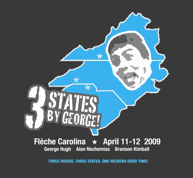
Wednesday, April 15, 2009
Out of Time
No one said it, but we all knew this was our last half-court shot to tie it at the buzzer. We'd already sunk two to send our flèche into double-overtime, like Jeff Capel and his underdog 'Devils back in '95. If this call about our direction was the right one, one more time, we still had a shot at a successful finish. But only a shot. We'd dribbled away any guarantees miles down the road.
The decision was to keep riding for the Rutherfordton exit. We were on US74, an eight-lane behemoth just like 64 in Wake and Chatham. Traffic was non-existent thanks to the ungodly hour of 4:30am, but the highway was hilly and monotonous. With every exit we passed, second-guessing threatened to drive us insane. We were thinking we'd made a wrong turn, but my memory of the map said that if we kept going north and west, we'd reach Rutherfordton. My buddies weren't so sure. So when the Rutherfordton exit sign slowly appeared out of the mist, we all gave a whoop and picked up the pace. For a minute. Until an even bigger problem quickly brought us back to reality...
Our flèche had started more or less according to plan. We didn't get all of the sleep we wanted, but considering what many of our friends were riding in that night, we still counted ourselves lucky. The moon was peeking through cotton candy clouds in the hour before dawn. It was cool and still damp from all of the rain. Only two cars had passed by on the Blue Ridge Parkway since we'd been up and about, a great omen. Ray, the owner of our cabins, walked down with his black Lab to sign our cards and wish us luck. We were off.
Alan and I had scouted several routes off the Parkway a few weeks back. From the car, it hadn't seemed too hilly and I had thought about attempting this fleche on my fixie. It didn't take more than a few miles to realize what a disaster that would have been. What had I been thinking?! Note to self: scouting from a car is better than nothing, but it doesn't beat riding.
We plotted our route with Google Maps and lived with some of its quirks. The first hiccup routed us off the BRP in sight of our US21 exit and onto a steep dirt road. Alan did a pretty good Phil Ligget impression, "he's digging deep into his suitcause of courage for this '53 Giro d'Italia.." It was a beautiful diversion. If only we'd seen that this was just the first of many. George took the first state line sprint.
We made our first control in Roaring Gap just 15 minutes behind schedule. The jackets stayed on, and we screamed down a four-mile descent into the Piedmont. A right onto Austin-Traphill Road from Chet & Cyndy's 1000K, and we were having fun. George blamed his new rack for slowing him on the descent, but it looked like his rear tire needed air. He rode on anyway. A few more turns and we're looking for Austin-Traphill again. Some confusion, a farmer gave us his take on directions, and we got back on course. (Later we learned we were on the right road to begin with.)
Seeing a pattern here? We're not 50 miles into the ride and we're already stumped by several turns. There's this magical tool called a "map" that really could have come in handy. I take the blame for not having one for every leg. The ride would have been so much easier.
We even had trouble finding our lunch control in Elkin. And we had more trouble leaving it. But as soon as we got on Swan Creek Road, everything clicked and we were moving. George and Alan were riding strong, I was the weakest link. We rode through some of the prettiest landscapes, rolling farms and meadows, hills all around. The grass was this luminescent green, like Ireland must be. We came upon Old Rash Road and we couldn't resist a picture. George even grabbed his tube of Chamois Butt'r to add to the joke.
We were on another dirt road when George flatted for a second time. A couple of cars stopped to ask if we needed anything. "If he keeps flatting, we're gonna need some tubes!" Turns out he didn't have any more issues. Alan's Topeak Mini Morph pump is the bomb. Lots of randonneurs use it, and now I know why.
The longest leg of our ride took us 70 miles from Elkin to Boger City. We purposefully designed this section without controls so we'd make good time. Our strategy paid off, as we made BC at 17:30. Our rolling average jumped from 15.2 to 16.0. We sat down to eat at a Subway and called our families and friends. Mike rang with the sad news that his team had finished outside the time limit. Bad weather and missing road signs did them in. The road signs saga sounded strangely familiar.
We still had good daylight left on the road to Clover, South Carolina, and we used it to our advantage. Again, beautiful riding. We had our lights on when we arrived but only for show. Alan took the state line sprint. Our break here was a little longer as we adjusted lights and got our night gear together.
Back on the road, this time to Blacksburg, SC, and the potholed roads really shook us up. Growing up in North Carolina, we were taught that we lived in "The Good Roads State." The last few years, I've smirked at that nickname, but no more. Compared to our cousins to the south, we are rolling on velvet up here. What's weird, though, is that SC has many more "Share The Road" signs than we do. If we could just get both those ideas together in one state..
The leg to Blacksburg was tough. Very hilly once again, and we were getting confused at the intersections. The moon rose red, glaring over our shoulders, then she cooled to a bright white. She was a good distraction as we struggled up SC 5, which seemed to climb forever.
The regulars at the Flying J truck stop gave us curious glances. Midnight's a weird hour to see cyclists mingling among the 18 wheelers. But everyone was friendly, and the food hit the spot. I got an omelet and hash browns with a side order of head-on-the-table nap. We only needed to go 56 more miles and we had 7 hours to do it. Instead of taking advantage of it though, we squandered it. We didn't leave until nearly 2am, and immediately things went wrong.
We weren't sure of the road name out front, so we asked around. Finally got some directions and headed out. That's when we promptly sailed by the first turn and ended up in a North Carolina town named "Earl." It took us a while to realize we were lost, since most of the road signs are for the intersecting road only, leaving out the road being traveled. Eventually we U-turned and headed back. I won the state line sprint fair and square but George waved it off since we were not on the route. Down the road, as plain as day, we saw our mistake and resumed the correct course, but now 35 minutes had been shaved off the clock. Adding insult to injury, my cell phone died too.
Funny how one ride can hold some of my favorite memories, and some of my worst too. But climbing up dirt farming lanes with cows shadowed in the moonlight are scenes I'll never forget. Absolutely gorgeous. And at one point, a very persistent whip-poor-will seemed to be following us. We heard his energetic call for miles.
We were navigating well again through Boiling Springs, and the clock seemed to at least tolerate us. It'd have to be a very short control in Rutherfordton, but we could still make it. No room for mistakes.
And that's when the biggest one jumped up and bit us, and we didn't even realize it.
Dixon Road, also known as US74, was to take us into Ellenboro, through Forest City and into Rutherfordton. What we didn't realize was that there are several 74s in this area: US74-A, NC74, US74 Business and US74 Bypass. Without a map, we were clueless as to which one we actually needed, and simply followed the cue sheet, which showed a 11 mile stretch on 74. That's a long cue, especially when it's the wrong one.
It hadn't hit us yet when we whooped it up for the "Rutherfordton" exit. But back to the basketball analogy, we had drained the half-court jumper only to learn the buzzer had gone off before the ball left our hands. Because now, nothing matched up on our cue sheets, and without a map, we were forced to ride through a very hilly town without knowing where we were, or where we were going.
We rode hard before giving up at 05:40, 40 minutes after our designated 22-hour control time. Alan grabbed an ATM receipt, and we called the Waffle House control for directions. After even more misdirection, we finally fell into a booth and ordered enough food to feed a good-sized family. We napped and waited for the sun before riding on to the finish a little after 10:30.
RBA Tony G hadn't heard from us and had no idea what was going on. I was the only one with his number in my phone and it had died hours ago. Another example of poor planning and maybe a bit of arrogance on my part too. In any case, I apologize, Tony, and thanks for being so calm, cool and collected.
We were disappointed we didn't complete the ride as required, but make no mistake- it was still a lot of fun! If you haven't ridden a flèche yet, find a team or make your own. Even this one still ranks up there as one of my favorite rides, ever. Seriously. The camaraderie, the exploring new roads and new towns, the uncertainty of success, make it a big blast. And as Alan said- a guarantee of success is not what this kind of ride is about- it's an adventure.
So what did I learn? Take maps. Go over the cue sheets better. Be more humble and less sure of success. 'Cause if you need a half-court shot to keep you in the game, it's a sign that the rest of your game may be off the mark.
unofficial numbers from my computer...
total time: 27h 32m 28s
miles: 259
rolling avg: 14.3
climbing: 13,420 ft
max hr: 227 (yeah, right!!!)
avg hr: 117
calories burned: 15,792
Monday, April 13, 2009


Subscribe to:
Posts (Atom)